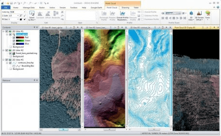
ERDAS IMAGINE allows you to create information from imagery. In addition, with ERDAS IMAGINE, you can visualize your results in 2D, 3D, movies, and on cartographic quality map compositions.ERDAS IMAGINE performs advanced remote sensing analysis and spatial modeling to create new information


Comments (7)